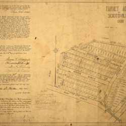
1912 Plat Map of Farney Addition to Sciotoville
Title
1912 Plat Map of Farney Addition to Sciotoville
Description
Browned, aged plat map of the Farney Addition to Sciotoville in 1912. On left side of the map there is information regarding this addition in Porter Township.
Located on the bottom left corner, there is a seal of a "Notary Public" by Francisco Lucero of Dona Ana County, New Mexico.
Located on the bottom left corner, there is a seal of a "Notary Public" by Francisco Lucero of Dona Ana County, New Mexico.
Creator
Unknown
Date
1912
Contributor
Map donated by Julia Basham
Format
27 x 17.7 inches map
Coverage
Sciotoville, Porter Township, Scioto County, Ohio
Rights
Scioto County Public Library
Collection
Citation
Unknown, “1912 Plat Map of Farney Addition to Sciotoville,” Local History Digital Collection, accessed January 6, 2025, https://yourppl.org/history/items/show/25622.

