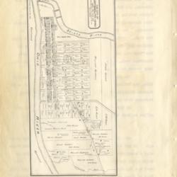
Map of Portsmouth, about 1820
Title
Map of Portsmouth, about 1820
Description
Photo image of scanned scrapbook page. Pictured: Map of Portsmouth, about 1820
Creator
Henry A. Lorberg
Date
Unknown
Format
Scanned scrapbook page
Coverage
Portsmouth, Scioto County, Ohio
Rights
Scioto County Public Library
Collection
Citation
Henry A. Lorberg , “Map of Portsmouth, about 1820 ,” Local History Digital Collection, accessed January 1, 2025, https://yourppl.org/history/items/show/22376.

