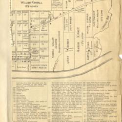
Hand Drawn Map of Portsmouth in 1819 and 1820 with a City Directory Below
Title
Hand Drawn Map of Portsmouth in 1819 and 1820 with a City Directory Below
Description
Photo image of scanned scrapbook page. Pictured is the second half of map and city directory below for Portsmouth. The city was platted by Henry Massie in 1803.
Creator
Henry A. Lorberg
Date
Unknown
Format
Scanned scrapbook page
Coverage
Portsmouth, Scioto County, Ohio
Rights
Scioto County Public Library
Collection
Citation
Henry A. Lorberg , “Hand Drawn Map of Portsmouth in 1819 and 1820 with a City Directory Below ,” Local History Digital Collection, accessed January 10, 2025, https://yourppl.org/history/items/show/21444.

